20% Increase: Satellite and AI technologies have been shown to boost crop yields by up to 20% by enabling more precise management of inputs and resources
2. Cost Savings and Input Efficiency
18% Less Fertilizer: Satellite-guided variable-rate application reduces fertilizer use by 18%, lowering costs and environmental impact
20–25% Water Savings: Optimized irrigation, informed by satellite moisture data, reduces water usage by 20–30%
3. Return on Investment (ROI)
22.3% Average ROI Increase: Meta-analyses show precision agriculture technologies deliver an average ROI boost of 22.3%, with significant economic gains for adopters.
First-Season ROI: Many farms see a positive ROI within the first season due to reduced input costs and higher yields, especially when targeting “bottleneck” zones (e.g., drought-prone or pest-affected areas)
4. Environmental and Regulatory Benefits
Carbon Sequestration and Compliance: Satellite data helps track and document carbon sequestration, supporting access to environmental markets and compliance with sustainability regulations.
Reduced Runoff and Emissions: Precision application of inputs cuts nutrient runoff by up to 31 kg/ha and reduces greenhouse gas emissions by 14%.
Platform Features
Satellite-based precision agriculture delivers significant economic benefits, supported by recent data and studies:
True Color Satellite Image
True color optical view.
Vegetation Index
Measuring chlorophyll content and canopy density.
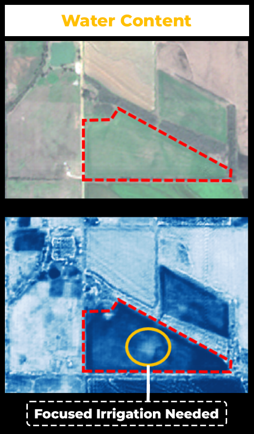
Water/Humidity Index
Quantifying water content in vegetation and soil moisture.
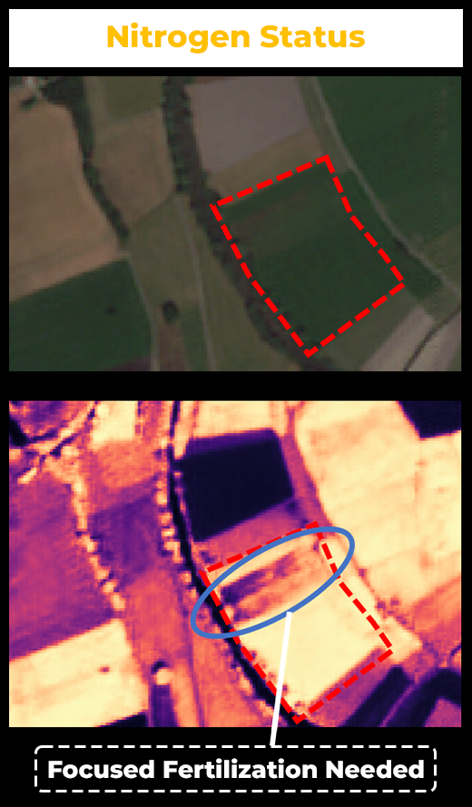
Plant Maturity and Nitorgen Status
Outlining crop maturity as well as nitrogen status.
Monitor your crop performance on a statewide scale
True Color, NDVI, NDRE, NDMI – Full vegetation and moisture analysis
5m Resolution – Detailed field monitoring
Statewide Updates Every 5 Days – Near-real-time insights
Monitor Your Farm & State – Local and statewide perspective